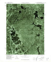
1975 Map of Oxford
USGS Topo · Published 1981About this map
Lake Chaubunagungamaug dominates the southwestern portion of this orthophotoquad, serving as a landmark in the transition between the industrial centers of Webster and Oxford. Produced by the United States Geological Survey from 1975 aerial photography, this map uses rectified imagery to reveal the density of the Douglas Woods and the interconnected water systems that once powered the region's manufacturing.
Find a feature on this map
9 named features on this map. Tap any name to fly to it.
Don’t see what you’re looking for? This feature index may not catch every label — zoom into the map to look around manually.
Map Details
Editions of this 1975 Oxford Map
This is the sole edition of this map. No revisions or reprints were ever made.
Other maps of this area

1886 · Blackstone
USGS Topo · 1:62,500

1889 · Blackstone
USGS Topo · 1:62,500

1889 · Webster
USGS Topo · 1:62,500

1889 · Putnam
USGS Topo · 1:62,500

1889 · Burrillville
USGS Topo · 1:62,500

1892 · Webster
USGS Topo · 1:62,500

1893 · Putnam
USGS Topo · 1:62,500

1893 · Blackstone
USGS Topo · 1:62,500

1894 · Burrillville
USGS Topo · 1:62,500

1900 · Blackstone
USGS Topo · 1:62,500