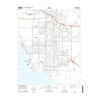
2015 Map of Oxnard
USGS Topo · Published 2015About this map
Oxnard and its neighboring coastal communities are defined by a complex grid of residential development, agriculture, and maritime industry along the Pacific Ocean. This survey captures the mid-2010s landscape of southern Ventura County, where the sprawling city limits of San Buenaventura (Ventura) meet the northern edge of the Santa Clara River. The map provides detailed documentation of the area's shoreline, from the residential enclaves of Oxnard Shores and Hollywood by the Sea to the deep-water facilities at Port Hueneme. Inland, the importance of civic and educational infrastructure is evident in the presence of Oxnard Airport and Oxnard College. Genealogists will find particular value in the clearly marked locations of the Ivy Lawn Cemetery, Santa Clara Cemetery, Japanese Cemetery, and Masonic Cemetery, which speak to the diverse history and multi-generational settlement of this coastal plain.
Find a feature on this map
287 named features on this map. Tap any name to fly to it.
Don’t see what you’re looking for? This feature index may not catch every label — zoom into the map to look around manually.
Map Details
Editions of this 2015 Oxnard Map
This is the sole edition of this map. No revisions or reprints were ever made.
Other maps of this area

1903 · Santa Paula
USGS Topo · 1:62,500

1904 · Ventura
USGS Topo · 1:62,500

1904 · Hueneme
USGS Topo · 1:62,500

1941 · Ventura
USGS Topo · 1:62,500

1942 · Santa Paula
USGS Topo · 1:62,500

1942 · Hueneme
USGS Topo · 1:62,500

1943 · Hueneme
USGS Topo · 1:62,500

1947 · Santa Paula
USGS Topo · 1:62,500

1949 · Los Angeles
USGS Topo · 1:250,000

1949 · Oxnard
USGS Topo · 1:24,000