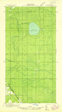
1931 Map of Ozark SE
USGS Topo · Published 1931About this map
East Lake serves as the central anchor for this 1931 survey of the Upper Peninsula, situated along the county line between Chippewa and Mackinac counties. The landscape is defined by an intricate network of waterways, including the winding Carp River and its North Fork, alongside Taylor Creek, Flat Creek, and Red Creek. These streams weave through a terrain marked by wetlands and the prominent rise of Maple Hill to the northeast.
Find a feature on this map
12 named features on this map. Tap any name to fly to it.
Don’t see what you’re looking for? This feature index may not catch every label — zoom into the map to look around manually.
Map Details
Editions of this 1931 Ozark SE Map
2 editions found
Other maps of this area

1931 · St Ignace NW
USGS Topo · 1:31,680

1931 · Moran NE
USGS Topo · 1:31,680

1931 · Ozark SE
USGS Topo · 1:31,680

1948 · Moran NE
USGS Topo · 1:31,680

1948 · Moran NW
USGS Topo · 1:31,680

1953 · Fibre
USGS Topo · 1:24,000

1954 · Sault Sainte Marie
USGS Topo · 1:250,000

1955 · Cheboygan
USGS Topo · 1:250,000

1956 · Sault Sainte Marie
USGS Topo · 1:250,000

1957 · Sault Sainte Marie
USGS Topo · 1:250,000