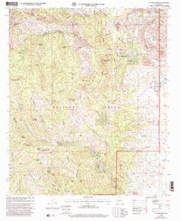
1999 Map of P A Mountain
USGS Topo · Published 2002About this map
Tierra Blanca Ranch and Mackey Ranch anchor the human presence in this high-altitude landscape within the Gila National Forest. The 1999 revision captures a network of resource-dependent infrastructure, from water management features like Silver Tail Tank and Lockwood Well to the extractive history suggested by the Silvertail Mine. The terrain is characterized by a series of prominent summits including P A Mountain, Signal Peak, and Seven Brothers Mountain, which overlook deep drainages such as Trujillo Canyon and Berrenda Creek.
Find a feature on this map
58 named features on this map. Tap any name to fly to it.
Don’t see what you’re looking for? This feature index may not catch every label — zoom into the map to look around manually.
Map Details
Editions of this 1999 P A Mountain Map
This is the sole edition of this map. No revisions or reprints were ever made.
Other maps of this area

1935 · Hillsboro
USGS Topo · 1:48,000

1940 · Hillsboro
USGS Topo · 1:62,500

1955 · Las Cruces
USGS Topo · 1:250,000

1956 · Dwyer
USGS Topo · 1:62,500

1956 · San Lorenzo
USGS Topo · 1:62,500

1958 · Las Cruces
USGS Topo · 1:250,000

1962 · Lake Valley
USGS Topo · 1:62,500

1982 · Hatch
USGS Topo · 1:100,000
1985 · Dwyer
USGS Topo · 1:24,000
1985 · P A Mountain
USGS Topo · 1:24,000