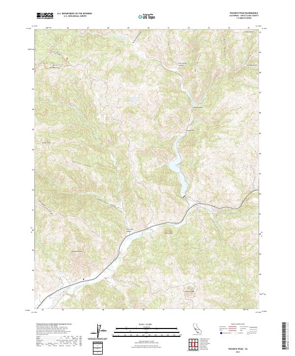
2021 Map of Pacheco Peak
USGS Topo · Published 2021About this map
Pacheco Peak and the surrounding terrain of the southern Diablo Range define this area of Santa Clara County, characterized by a series of prominent ridges and deep canyons. The landscape is marked by distinctive geological features such as Chimney Rock and the sharp rise of Elephant Head, which overlooks the drainage of Elephant Head Cr. The central drainage system of Pacheco Cr winds through Hurricane Canyon and past the steep bluff of Lovers Leap, following a natural corridor through the hills.
Find a feature on this map
41 named features on this map. Tap any name to fly to it.
Don’t see what you’re looking for? This feature index may not catch every label — zoom into the map to look around manually.
Map Details
Editions of this 2021 Pacheco Peak Map
This is the sole edition of this map. No revisions or reprints were ever made.
Other maps of this area

1919 · Hollister
USGS Topo · 1:48,000

1920 · Pacheco Pass
USGS Topo · 1:62,500

1921 · Gilroy Hot Springs
USGS Topo · 1:62,500

1921 · Hollister
USGS Topo · 1:62,500

1922 · Quien Sabe
USGS Topo · 1:62,500

1923 · Hollister
USGS Topo · 1:62,500

1939 · Gilroy Hot Springs
USGS Topo · 1:62,500

1940 · Gilroy Hot Springs
USGS Topo · 1:62,500

1940 · Hollister
USGS Topo · 1:62,500

1940 · Pacheco Pass
USGS Topo · 1:62,500