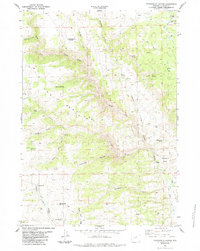
1984 Map of Packsaddle Canyon
USGS Topo · Published 1984About this map
The North Fork Powder River carves a complex course through this corner of Johnson County, where high-country ranching and mining infrastructure define the landscape. Landowners and land managers in the 1980s utilized a network of water improvements, including the Red Spring Reservoir and numerous named water sources like Charlie Brown Springs and Hammond Spring to support livestock. The presence of the Top Hand Mine and Emerald Park Mine in the northeast suggests the area's continued mineral interest, while the Canon Ditch and a Gaging Sta on the river reflect the critical management of water in this semi-arid terrain.
Find a feature on this map
30 named features on this map. Tap any name to fly to it.
Don’t see what you’re looking for? This feature index may not catch every label — zoom into the map to look around manually.
Map Details
Editions of this 1984 Packsaddle Canyon Map
This is the sole edition of this map. No revisions or reprints were ever made.
Other maps of this area

1899 · Cloud peak
USGS Topo · 1:125,000

1900 · Fort McKinney
USGS Topo · 1:125,000

1901 · Cloud Peak
USGS Topo · 1:125,000

1903 · Fort McKinney
USGS Topo · 1:125,000

1955 · Sheridan
USGS Topo · 1:250,000

1955 · Arminto
USGS Topo · 1:250,000

1958 · Sheridan
USGS Topo · 1:250,000

1958 · Arminto
USGS Topo · 1:250,000

1962 · Sheridan
USGS Topo · 1:250,000

1962 · Arminto
USGS Topo · 1:250,000