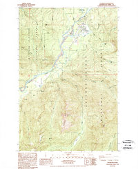
1989 Map of Packwood
USGS Topo · Published 1989About this map
Packwood serves as the central hub of this mountain landscape, situated along the Cowlitz River and surrounded by the dense reaches of the Gifford Pinchot National Forest. This late-1980s data reflects a community deeply tied to forestry and outdoor access, evidenced by the prominent Ranger Station and a local Landing Strip. The river's winding course is the primary valley floor feature, shadowed by landmarks like Skyo Mtn and the sheer Cougar Rocks to the northwest.
Find a feature on this map
32 named features on this map. Tap any name to fly to it.
Don’t see what you’re looking for? This feature index may not catch every label — zoom into the map to look around manually.
Map Details
Editions of this 1989 Packwood Map
This is the sole edition of this map. No revisions or reprints were ever made.
Other maps of this area

1924 · Mt Rainier
USGS Topo · 1:96,000

1926 · Steamboat Mtn
USGS Topo · 1:125,000

1928 · Mt Rainier
USGS Topo · 1:125,000

1931 · Steamboat Mtn
USGS Topo · 1:125,000

1950 · Yakima
USGS Topo · 1:250,000

1958 · Yakima
USGS Topo · 1:250,000

1961 · Yakima
USGS Topo · 1:250,000

1962 · Randle
USGS Topo · 1:62,500

1962 · Packwood
USGS Topo · 1:62,500
1965 · Tower Rock
USGS Topo · 1:24,000