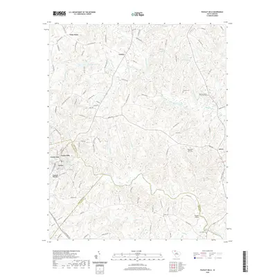
2020 Map of Pacolet Mills
USGS Topo · Published 2020About this map
The Pacolet River winds through the heart of this South Carolina landscape, defining the industrial and social development of communities like Pacolet Mills and Central Pacolet. This modern survey documents the contemporary footprint of these historic textile and mill towns at the junction of Spartanburg, Union, and Cherokee counties. Highlighting the area's genealogical depth, the map identifies numerous family and community landmarks, including the Mount Zion Baptist Church Graveyard and Whig Hill Cem.
Find a feature on this map
112 named features on this map. Tap any name to fly to it.
Don’t see what you’re looking for? This feature index may not catch every label — zoom into the map to look around manually.
Map Details
Editions of this 2020 Pacolet Mills Map
This is the sole edition of this map. No revisions or reprints were ever made.
Other maps of this area

1909 · Gaffney
USGS Topo · 1:62,500

1941 · Spartanburg
USGS Topo · 1:250,000

1947 · Spartanburg
USGS Topo · 1:62,500

1949 · Spartanburg
USGS Topo · 1:62,500

1953 · Spartanburg
USGS Topo · 1:250,000

1953 · Charlotte
USGS Topo · 1:250,000

1954 · Charlotte
USGS Topo · 1:250,000

1959 · Cowpens
USGS Topo · 1:62,500

1960 · Charlotte
USGS Topo · 1:250,000

1960 · Spartanburg
USGS Topo · 1:250,000