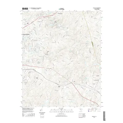
2017 Map of Pacolet
USGS Topo · Published 2017About this map
The Pacolet River and its major tributary, Lawsons Fork Creek, dominate this part of Spartanburg County, reflecting a landscape long defined by water power and industrial ponding. The map details the mill-town legacies of Clifton and Glendale, where several numbered impoundments such as Clifton Mill Number One Pond and Clifton Mill Number Two Pond illustrate the historical footprint of textile operations along the shoals. Further south, the industry shifts toward mineral extraction, noted by the Lithium Corporation Pond near Calico. This 2017 survey also documents significant historical land use at Camp Croft, preserving the spatial layout of the former military training site. For those tracing local families, numerous small burial grounds are identified, including the Brown Family Cem and Willis Cem, scattered among the residential hubs of Converse and White Stone.
Find a feature on this map
55 named features on this map. Tap any name to fly to it.
Don’t see what you’re looking for? This feature index may not catch every label — zoom into the map to look around manually.
Map Details
Editions of this 2017 Pacolet Map
This is the sole edition of this map. No revisions or reprints were ever made.
Other maps of this area

1909 · Gaffney
USGS Topo · 1:62,500

1941 · Spartanburg
USGS Topo · 1:250,000

1947 · Spartanburg
USGS Topo · 1:62,500

1949 · Spartanburg
USGS Topo · 1:24,000

1949 · Spartanburg
USGS Topo · 1:62,500

1953 · Spartanburg
USGS Topo · 1:250,000

1953 · Charlotte
USGS Topo · 1:250,000

1954 · Charlotte
USGS Topo · 1:250,000

1959 · Cowpens
USGS Topo · 1:62,500

1960 · Charlotte
USGS Topo · 1:250,000