2024 Map of Pacolet
USGS Topo · Published 2024About this map
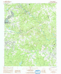
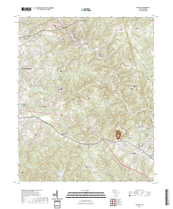
The Pacolet River and its numerous tributaries, including Lawsons Fork Creek and Richland Creek, define the topography of this Spartanburg County landscape. The settlement of Pacolet sits at the heart of a dense network of smaller communities such as Central Pacolet, Glendale, and Clifton. The map reveals a deeply established social fabric evidenced by the high concentration of religious and memorial sites, ranging from the Mount Sinai Church of God to family-specific locations like the Hammett Family Cem.
Find a feature on this map
249 named features on this map. Tap any name to fly to it.
Don’t see what you’re looking for? This feature index may not catch every label — zoom into the map to look around manually.
Map Details
Editions of this 2024 Pacolet Map
This is the sole edition of this map. No revisions or reprints were ever made.