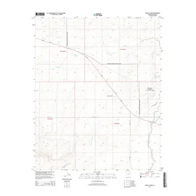
2014 Map of Padilla Tank
USGS Topo · Published 2014About this map
Petrified Forest National Park boundaries define the eastern and northern reaches of this high-desert landscape in Navajo County. The terrain is characterized by a network of drainage washes and ranching-related water catchments, reflecting the region's arid climate and agricultural history. Notable water features include Padilla Tank, Ortega Tank, and the uniquely named Dead Cow Tank. The presence of Broken Dam Tank suggests the ongoing challenges of water management in this environment. Drainage systems like Cottonwood Wash and Mexican Hollow Wash carve through the area, which is bisected by Us-180 and the Petrified Forest Loop Rd. This 2014 survey serves as a record of the park's interface with private or state-managed lands, showing the infrastructure of power lines and rural highways that cross the open plains.
Find a feature on this map
20 named features on this map. Tap any name to fly to it.
Don’t see what you’re looking for? This feature index may not catch every label — zoom into the map to look around manually.
Map Details
Editions of this 2014 Padilla Tank Map
This is the sole edition of this map. No revisions or reprints were ever made.
Other maps of this area

1886 · St Johns
USGS Topo · 1:250,000

1886 · Holbrook
USGS Topo · 1:250,000

1892 · St Johns
USGS Topo · 1:250,000

1893 · Holbrook
USGS Topo · 1:250,000

1912 · Petrified Forest
USGS Topo · 1:62,500

1954 · Holbrook
USGS Topo · 1:250,000

1954 · Saint Johns
USGS Topo · 1:250,000

1955 · Petrified Forest
USGS Topo · 1:62,500

1955 · Adamana 3 NE
USGS Topo · 1:24,000

1955 · St. Joseph 1 NE
USGS Topo · 1:24,000