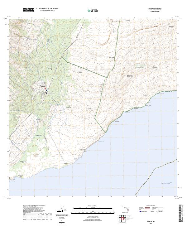
2024 Map of Pahala
USGS Topo · Published 2024About this map
The settlement of Pāhala serves as the primary hub on this southeastern portion of the Island of Hawaiʻi, where the local landscape is defined by its volcanic legacy. Community life is centered around a grid of streets including Pakalana St and Mill Camp Rd, with several distinct burial grounds such as the Pahala Chinese Cem and the Pahala Filipino Methodist Church Cem reflecting the diverse history of the area. Just outside the residential center, the Pahala Airstrip sits near the foot of numerous gulches like Pīkea Gulch and Kaʻalaʻala Gulch.
Find a feature on this map
55 named features on this map. Tap any name to fly to it.
Don’t see what you’re looking for? This feature index may not catch every label — zoom into the map to look around manually.
Map Details
Editions of this 2024 Pahala Map
This is the sole edition of this map. No revisions or reprints were ever made.
Other maps of this area

1921 · Kilauea
USGS Topo · 1:62,500

1923 · Pahala
USGS Topo · 1:62,500

1924 · Kilauea
USGS Topo · 1:62,500

1924 · Honuapo
USGS Topo · 1:62,500

1928 · Mauna Loa
USGS Topo · 1:62,500

1954 · Hawaii South
USGS Topo · 1:250,000

1959 · Hawaii South
USGS Topo · 1:250,000

1961 · Hawaii South
USGS Topo · 1:250,000

1962 · Hawaii South
USGS Topo · 1:250,000
1962 · Naalehu
USGS Topo · 1:24,000