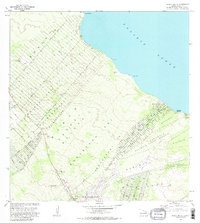
1981 Map of Pahoa North
USGS Topo · Published 1981About this map
The coastal forests and growing homesteads of Puna dominate this 1981 survey of the shoreline south of Hilo. The landscape is defined by the Lava Flow 1840, a geological scar that cuts across the Nanawale Forest Reserve toward the Pacific Ocean. Development patterns are evident in the vast grid of the Keonepoko Homesteads and the residential tracks branching from Railroad Ave and Paradise Drive. Along the rocky coast, landmarks like Honolulu Landing and Kaloli Point mark the interface between the volcanic land and the sea, while the Makuu (Site) suggests earlier settlement locations. In the interior, the Pahoa Landing Strip and a National Guard Reservation provide infrastructure for this expanding rural community during the early 1980s.
Find a feature on this map
30 named features on this map. Tap any name to fly to it.
Don’t see what you’re looking for? This feature index may not catch every label — zoom into the map to look around manually.
Map Details
Editions of this 1981 Pahoa North Map
2 editions found
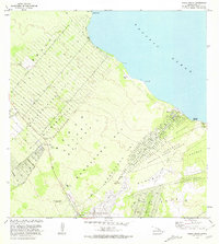
Other maps of this area

1917 · Hilo
USGS Topo · 1:62,500

1922 · Puna
USGS Topo · 1:62,500

1924 · Makuu
USGS Topo · 1:62,500

1924 · Puna
USGS Topo · 1:62,500

1924 · Kalapana
USGS Topo · 1:62,500

1932 · Hilo
USGS Topo · 1:62,500

1954 · Hawaii South
USGS Topo · 1:250,000

1954 · Hawaii North
USGS Topo · 1:250,000

1959 · Hawaii South
USGS Topo · 1:250,000

1959 · Hawaii North
USGS Topo · 1:250,000