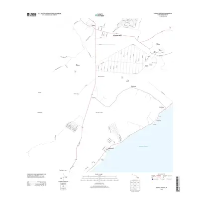
2013 Map of Pahoa South
USGS Topo · Published 2013About this map
Pāhoa serves as the inland anchor for this coastal stretch of the Island of Hawai‘i, where the volcanic legacy of the Puna District is etched into the landscape. The map explicitly delineates the Lava Flow of 1955 and the ancient Lava Flow of 1750, providing a clear spatial record of how these eruptions reshaped the terrain. Settlement patterns follow a distinct grid in residential areas like Kaniahiku Village and Leilani Ave, contrasting with the more dispersed coastal hamlets. Along the rugged southeastern shore, features like Kehena Beach, Waipuku Point, and Kalepa Point mark the interface between the volcanic rock and the Pacific Ocean. Inland, a series of prominent vents and depressions including Puulena Crater, Pawai Crater, and Iilewa Crater dominate the topography, illustrating the area's ongoing geological transformation.
Find a feature on this map
107 named features on this map. Tap any name to fly to it.
Don’t see what you’re looking for? This feature index may not catch every label — zoom into the map to look around manually.
Map Details
Editions of this 2013 Pahoa South Map
This is the sole edition of this map. No revisions or reprints were ever made.
Other maps of this area

1917 · Hilo
USGS Topo · 1:62,500

1922 · Puna
USGS Topo · 1:62,500

1924 · Makuu
USGS Topo · 1:62,500

1924 · Puna
USGS Topo · 1:62,500

1924 · Kalapana
USGS Topo · 1:62,500

1932 · Hilo
USGS Topo · 1:62,500

1954 · Hawaii South
USGS Topo · 1:250,000

1954 · Hawaii North
USGS Topo · 1:250,000

1959 · Hawaii South
USGS Topo · 1:250,000

1959 · Hawaii North
USGS Topo · 1:250,000