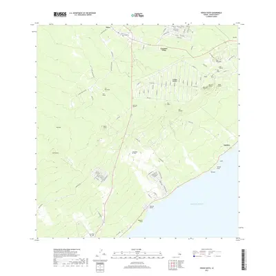
2017 Map of Pahoa South
USGS Topo · Published 2017About this map
The Lava Flow of 1955 and Lava Flow of 1750 dominate the Puna District landscape, illustrating the raw volcanic nature of the Island of Hawaiʹi. This survey documents the residential expansion of the early 21st century, with the organized grid of Leilani Estates and the cluster of Kaniahiku Village established atop older flows. The coastline is defined by steep points and volcanic beaches, such as Kehena Beach and Waipuku Point. Inland, the terrain is dotted with numerous cinder cones and volcanic vents, including Puu Honuaula, Puu Kaliu, and the distinctive Iilewa Crater. The transition from the rural village of Pāhoa to the more isolated settlements of Opihikao and Lolia reflects the challenges and patterns of living in an active volcanic zone just years before major shifts in the shoreline.
Find a feature on this map
97 named features on this map. Tap any name to fly to it.
Don’t see what you’re looking for? This feature index may not catch every label — zoom into the map to look around manually.
Map Details
Editions of this 2017 Pahoa South Map
This is the sole edition of this map. No revisions or reprints were ever made.
Other maps of this area

1917 · Hilo
USGS Topo · 1:62,500

1922 · Puna
USGS Topo · 1:62,500

1924 · Makuu
USGS Topo · 1:62,500

1924 · Puna
USGS Topo · 1:62,500

1924 · Kalapana
USGS Topo · 1:62,500

1932 · Hilo
USGS Topo · 1:62,500

1954 · Hawaii South
USGS Topo · 1:250,000

1954 · Hawaii North
USGS Topo · 1:250,000

1959 · Hawaii South
USGS Topo · 1:250,000

1959 · Hawaii North
USGS Topo · 1:250,000