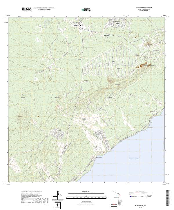
2024 Map of Pahoa South
USGS Topo · Published 2024About this map
Sacred Heart Catholic Church and a local Cem anchor the community of Pahoa in this recent survey of the Puna District. The landscape is a complex record of volcanic activity, clearly marking the extent of the Lava Flow of 1955 and the much older Lava Flow of 1750. These flows are interspersed with residential developments like Leilani Estates and Nanawale Estates, illustrating the intersection of human settlement and active geology on the Island of Hawai‘i. Along the southeastern coast, the map details the rugged shoreline from Waipuku Point through Kehena Beach to Kalepa Point. Numerous volcanic features, including Pawai Crater and Pu‘ulena Crater, dominate the inland topography, while coastal hamlets like ‘Opihikao and Seaview are connected by the Kalapana Kapoho Beach Rd.
Find a feature on this map
108 named features on this map. Tap any name to fly to it.
Don’t see what you’re looking for? This feature index may not catch every label — zoom into the map to look around manually.
Map Details
Editions of this 2024 Pahoa South Map
This is the sole edition of this map. No revisions or reprints were ever made.
Other maps of this area

1917 · Hilo
USGS Topo · 1:62,500

1922 · Puna
USGS Topo · 1:62,500

1924 · Makuu
USGS Topo · 1:62,500

1924 · Puna
USGS Topo · 1:62,500

1924 · Kalapana
USGS Topo · 1:62,500

1932 · Hilo
USGS Topo · 1:62,500

1954 · Hawaii South
USGS Topo · 1:250,000

1954 · Hawaii North
USGS Topo · 1:250,000

1959 · Hawaii South
USGS Topo · 1:250,000

1959 · Hawaii North
USGS Topo · 1:250,000