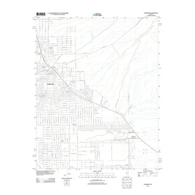
2012 Map of Pahrump
USGS Topo · Published 2012About this map
Pahrump emerges from the desert floor as a growing network of residential streets and agricultural legacies in the early twenty-first century. The landscape is defined by the natural drainage of Wheeler Wash and the presence of critical water sources like Pahrump Springs and Stump Springs. This survey documents a community in transition, where family-named properties such as Mankins Ranch, Manse Ranch, and Bennetts Ranch sit alongside modern developments and recreation sites. Local infrastructure and community hubs are well-represented, including the Pahrump Post Office, the Bob Budd Speedway, and the Pahrump Memorial Arena. The presence of the Caas-Hafen Landing Strip and Chief Tecopa Cemetery provides specific points of interest for genealogists and local historians tracking the development and population centers of this corner of Nye County.
Find a feature on this map
174 named features on this map. Tap any name to fly to it.
Don’t see what you’re looking for? This feature index may not catch every label — zoom into the map to look around manually.
Map Details
Editions of this 2012 Pahrump Map
This is the sole edition of this map. No revisions or reprints were ever made.
Other maps of this area

1907 · Las Vegas
USGS Topo · 1:250,000

1908 · Furnace Creek
USGS Topo · 1:250,000

1908 · Las Vegas
USGS Topo · 1:250,000

1910 · Furnace Creek
USGS Topo · 1:250,000

1948 · Death Valley
USGS Topo · 1:250,000

1954 · Las Vegas
USGS Topo · 1:250,000

1954 · Death Valley
USGS Topo · 1:250,000

1956 · Death Valley
USGS Topo · 1:250,000

1957 · Las Vegas
USGS Topo · 1:250,000

1957 · Death Valley
USGS Topo · 1:250,000