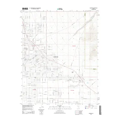
2015 Map of Pahrump
USGS Topo · Published 2015About this map
The growing community of Pahrump occupies this high desert landscape, illustrating the modern expansion of residential subdivisions across the arid floor of the Pahrump Valley. This survey captures the transition of the region from its historical agricultural roots toward a sprawling suburban footprint. Despite the proliferation of named streets, the map preserves the location of vital desert water sources including Pahrump Springs, Ivanpah Springs, and Stump Springs, which have long anchored human activity in the Mojave Desert.
Find a feature on this map
217 named features on this map. Tap any name to fly to it.
Don’t see what you’re looking for? This feature index may not catch every label — zoom into the map to look around manually.
Map Details
Editions of this 2015 Pahrump Map
This is the sole edition of this map. No revisions or reprints were ever made.
Other maps of this area

1907 · Las Vegas
USGS Topo · 1:250,000

1908 · Furnace Creek
USGS Topo · 1:250,000

1908 · Las Vegas
USGS Topo · 1:250,000

1910 · Furnace Creek
USGS Topo · 1:250,000

1948 · Death Valley
USGS Topo · 1:250,000

1954 · Las Vegas
USGS Topo · 1:250,000

1954 · Death Valley
USGS Topo · 1:250,000

1956 · Death Valley
USGS Topo · 1:250,000

1957 · Las Vegas
USGS Topo · 1:250,000

1957 · Death Valley
USGS Topo · 1:250,000