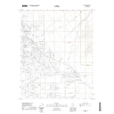
2021 Map of Pahrump
USGS Topo · Published 2021About this map
Pahrump Valley serves as a critical agricultural and residential hub in the high Mojave Desert near the California border. This modern survey illustrates the intricate network of residential streets and desert infrastructure that has expanded around vital water sources like Pahrump Springs and Manse Ranch Springs. The map documents significant local landmarks including the Nye County District Court and Caas Airport. Cultural sites such as Chief Tecopa Cem and Grandview Cem are clearly marked, providing essential points of interest for genealogists. The terrain is defined by the drainage of Wheeler Wash and numerous named springs, reflecting the region's historical reliance on groundwater for settlement and growth.
Find a feature on this map
26 named features on this map. Tap any name to fly to it.
Don’t see what you’re looking for? This feature index may not catch every label — zoom into the map to look around manually.
Map Details
Editions of this 2021 Pahrump Map
This is the sole edition of this map. No revisions or reprints were ever made.
Other maps of this area

1907 · Las Vegas
USGS Topo · 1:250,000

1908 · Furnace Creek
USGS Topo · 1:250,000

1908 · Las Vegas
USGS Topo · 1:250,000

1910 · Furnace Creek
USGS Topo · 1:250,000

1948 · Death Valley
USGS Topo · 1:250,000

1954 · Las Vegas
USGS Topo · 1:250,000

1954 · Death Valley
USGS Topo · 1:250,000

1956 · Death Valley
USGS Topo · 1:250,000

1957 · Las Vegas
USGS Topo · 1:250,000

1957 · Death Valley
USGS Topo · 1:250,000