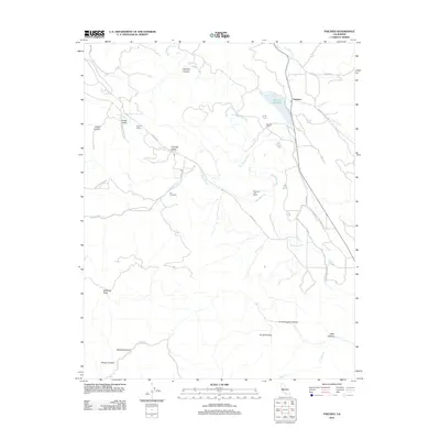
2012 Map of Paicines
USGS Topo · Published 2012About this map
The San Benito River defines the central corridor of this California landscape, where agricultural production and natural drainages meet. The small settlement of Paicines and the nearby Paicines Ranch serve as focal points near the intersection of Panoche Rd and Cienega Rd. The map highlights a regional viticulture presence with the labeling of Cygnet Cellars and Enz Vineyards, situated in the fertile stretches of Cienega Valley. Water management is prominent through the Paicines Reservoir and several major creek systems including Tres Pinos Cr and Pescadero Cr.
Find a feature on this map
31 named features on this map. Tap any name to fly to it.
Don’t see what you’re looking for? This feature index may not catch every label — zoom into the map to look around manually.
Map Details
Editions of this 2012 Paicines Map
This is the sole edition of this map. No revisions or reprints were ever made.
Other maps of this area

1910 · Gonzales
USGS Topo · 1:31,680

1919 · San Benito
USGS Topo · 1:62,500

1919 · Hollister
USGS Topo · 1:48,000

1921 · Gonzales
USGS Topo · 1:62,500

1921 · Hollister
USGS Topo · 1:62,500

1922 · Quien Sabe
USGS Topo · 1:62,500

1923 · Hollister
USGS Topo · 1:62,500

1931 · San Benito
USGS Topo · 1:62,500

1940 · Hollister
USGS Topo · 1:62,500

1940 · Quien Sabe
USGS Topo · 1:62,500