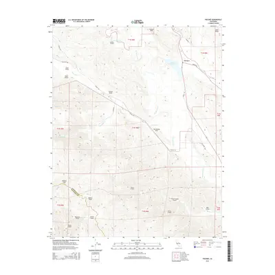
2015 Map of Paicines
USGS Topo · Published 2015About this map
The San Andreas Fault cuts a distinct northwest-southeast path through this section of San Benito County, marking the tectonic boundary between the Diablo Range to the east and the Gabilan Range to the southwest. This landscape is defined by its deep canyons and elevated peaks, including the prominent McPhails Peak and Swanson Bluff. Settlement is concentrated near the junction of Panoche Rd and Murphy Rd, where the community of Paicines sits adjacent to the Paicines Reservoir. The San Benito River and its various tributaries, such as Pescadero Cr and Tres Pinos Cr, drain the high country, following the natural troughs created by the complex fault systems. In the southern portion of the map, the boundary between San Benito and Monterey counties traverses high ridges near Swope Canyon and Matarana Gulch, highlighting the area's difficult topography and importance as a crossroads for early mountain passage via routes like the Old Airline Hwy.
Find a feature on this map
38 named features on this map. Tap any name to fly to it.
Don’t see what you’re looking for? This feature index may not catch every label — zoom into the map to look around manually.
Map Details
Editions of this 2015 Paicines Map
This is the sole edition of this map. No revisions or reprints were ever made.
Other maps of this area

1910 · Gonzales
USGS Topo · 1:31,680

1919 · San Benito
USGS Topo · 1:62,500

1919 · Hollister
USGS Topo · 1:48,000

1921 · Gonzales
USGS Topo · 1:62,500

1921 · Hollister
USGS Topo · 1:62,500

1922 · Quien Sabe
USGS Topo · 1:62,500

1923 · Hollister
USGS Topo · 1:62,500

1931 · San Benito
USGS Topo · 1:62,500

1940 · Hollister
USGS Topo · 1:62,500

1940 · Quien Sabe
USGS Topo · 1:62,500