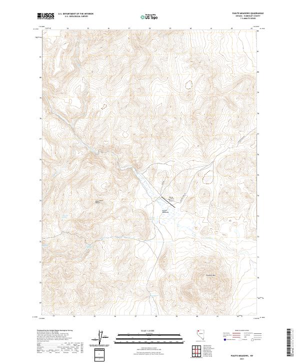
2021 Map of Paiute Meadows
USGS Topo · Published 2021About this map
Paiute Meadows anchors this arid basin landscape, where seasonal water sources and aviation infrastructure mark a sparsely settled portion of Humboldt County. The terrain is dominated by the steep rises of the Black Rock Range to the west and the prominent Elephant Mtn to the southeast. Vital water points for livestock or travelers are scattered throughout the hills, including Johnstone Springs, Onemile Spring, and Sheep Creek Spring.
Find a feature on this map
19 named features on this map. Tap any name to fly to it.
Don’t see what you’re looking for? This feature index may not catch every label — zoom into the map to look around manually.
Map Details
Editions of this 2021 Paiute Meadows Map
This is the sole edition of this map. No revisions or reprints were ever made.
Other maps of this area

1886 · Disaster
USGS Topo · 1:250,000

1889 · Long Valley
USGS Topo · 1:250,000

1893 · Disaster
USGS Topo · 1:250,000

1954 · Vya
USGS Topo · 1:250,000

1958 · Vya
USGS Topo · 1:250,000

1962 · Vya
USGS Topo · 1:250,000

1972 · Pinto Mountain
USGS Topo · 1:24,000

1972 · Burnt Springs
USGS Topo · 1:24,000

1972 · Big Mountain
USGS Topo · 1:24,000
1972 · Red Mountain
USGS Topo · 1:24,000