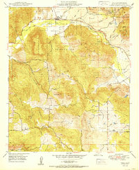
1950 Map of Pala
USGS Topo · Published 1950About this map
Pala Indian Reservation dominates this 1950 survey, showcasing the cultural and geographical landscape of northern San Diego County before extensive modern development. The settlement of Pala serves as a focal point, situated along the San Luis Rey River where the historic Mission and an Indian Cem are located. The map reveals a transition from traditional land use to mid-century infrastructure, marked by the prominent path of the San Diego Aqueduct cutting through the western hills and the presence of a private Airfield in the southern valley.
Find a feature on this map
34 named features on this map. Tap any name to fly to it.
Don’t see what you’re looking for? This feature index may not catch every label — zoom into the map to look around manually.
Map Details
Editions of this 1950 Pala Map
This is the sole edition of this map. No revisions or reprints were ever made.
Other maps of this area

1893 · Escondido
USGS Topo · 1:62,500

1901 · Escondido
USGS Topo · 1:62,500

1901 · San Luis Rey
USGS Topo · 1:125,000

1903 · Ramona
USGS Topo · 1:125,000

1904 · Southern California Sheet No. 2
USGS Topo · 1:250,000

1939 · Palomar Mountain
USGS Topo · 1:62,500

1942 · Temecula
USGS Topo · 1:62,500

1942 · Escondido
USGS Topo · 1:62,500

1942 · Ramona
USGS Topo · 1:62,500

1947 · Ramona
USGS Topo · 1:62,500