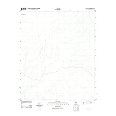
2012 Map of Palen Pass
USGS Topo · Published 2012About this map
The Granite Mountains define the northern reaches of this desert terrain, where the arid landscape is shaped by complex drainage networks and alluvial fans. This high-resolution survey from the U.S. Geological Survey focuses on the vital mountain corridor of Palen Pass, a key natural crossing point in the eastern Mojave region. The only established route through the valley is the unpaved Coxcomb Monument Rd, which winds through the gap between mountain ranges. The map provides a detailed view of the natural topography and primitive road networks as they existed in the early twenty-first century, tracing the subtle contours and washes that define the area's physical geography.
Find a feature on this map
3 named features on this map. Tap any name to fly to it.
Don’t see what you’re looking for? This feature index may not catch every label — zoom into the map to look around manually.
Map Details
Editions of this 2012 Palen Pass Map
This is the sole edition of this map. No revisions or reprints were ever made.
Other maps of this area

1942 · Blythe
USGS Topo · 1:250,000

1942 · Amboy
USGS Topo · 1:250,000

1943 · Amboy
USGS Topo · 1:250,000

1943 · Iron Mountains
USGS Topo · 1:62,500

1945 · Midland
USGS Topo · 1:62,500

1952 · Midland
USGS Topo · 1:62,500

1952 · Palen Mountains
USGS Topo · 1:62,500

1954 · Salton Sea
USGS Topo · 1:250,000

1954 · Needles
USGS Topo · 1:250,000

1954 · Rice
USGS Topo · 1:62,500