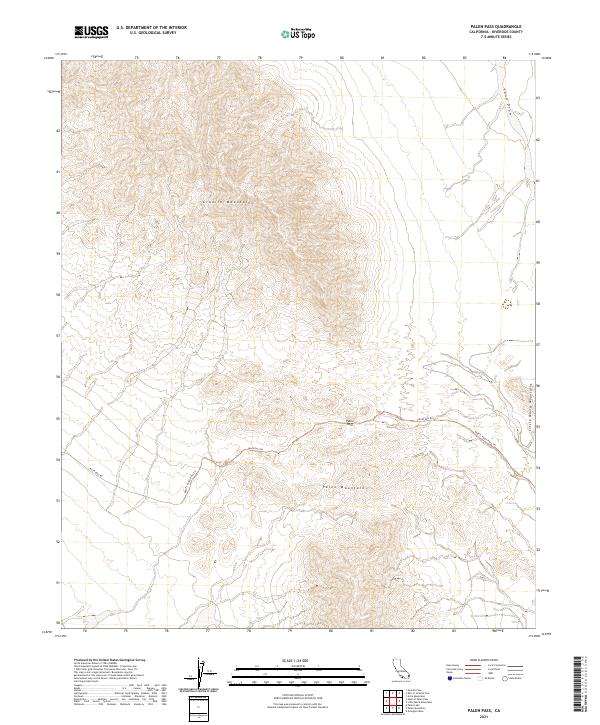
2021 Map of Palen Pass
USGS Topo · Published 2021About this map
Palen Pass serves as a critical topographic notch between the Granite Mountains to the north and the Palen Mountains to the south. This rugged landscape is defined by the high-elevation desert terrain of eastern Riverside County, where the dry bed of Sand Draw carves a path through the northeastern slopes. The map traces the historical desert passage along Palen Pass Rd, a primitive route that remains the primary corridor through this wilderness.
Find a feature on this map
11 named features on this map. Tap any name to fly to it.
Don’t see what you’re looking for? This feature index may not catch every label — zoom into the map to look around manually.
Map Details
Editions of this 2021 Palen Pass Map
This is the sole edition of this map. No revisions or reprints were ever made.
Other maps of this area

1942 · Blythe
USGS Topo · 1:250,000

1942 · Amboy
USGS Topo · 1:250,000

1943 · Amboy
USGS Topo · 1:250,000

1943 · Iron Mountains
USGS Topo · 1:62,500

1945 · Midland
USGS Topo · 1:62,500

1952 · Midland
USGS Topo · 1:62,500

1952 · Palen Mountains
USGS Topo · 1:62,500

1954 · Salton Sea
USGS Topo · 1:250,000

1954 · Needles
USGS Topo · 1:250,000

1954 · Rice
USGS Topo · 1:62,500