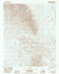
1983 Map of Palen Pass
USGS Topo · Published 1984About this map
The Granite Mountains and Palen Mountains converge in this arid Riverside County corridor, defined by the strategic crossing of Palen Pass. This 1983 survey documents a landscape shaped by extreme topography and sparse water sources, such as Packard Well and the ephemeral Sand Draw. The map reveals a history of resource extraction, indicated by several Mines tucked into the mountain slopes, and a primitive transportation network consisting of a winding Jeep Trail. Survey markers like BM 14 GWM 4490 and BM 16 GWM 3294 provide precise elevation data for the complex terrain. The drainage patterns of various Dry Wash features illustrate the geological character of this desert interior, where human presence is largely limited to mining and seasonal passage.
Find a feature on this map
18 named features on this map. Tap any name to fly to it.
Don’t see what you’re looking for? This feature index may not catch every label — zoom into the map to look around manually.
Map Details
Editions of this 1983 Palen Pass Map
This is the sole edition of this map. No revisions or reprints were ever made.
Other maps of this area

1942 · Blythe
USGS Topo · 1:250,000

1942 · Amboy
USGS Topo · 1:250,000

1943 · Amboy
USGS Topo · 1:250,000

1943 · Iron Mountains
USGS Topo · 1:62,500

1945 · Midland
USGS Topo · 1:62,500

1952 · Midland
USGS Topo · 1:62,500

1952 · Palen Mountains
USGS Topo · 1:62,500

1954 · Salton Sea
USGS Topo · 1:250,000

1954 · Needles
USGS Topo · 1:250,000

1954 · Rice
USGS Topo · 1:62,500