1978 Map of Palmdale
USGS Topo · Published 1981About this map
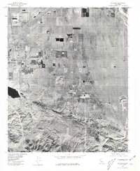
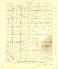
Palmdale appears here as a growing desert hub during the late 1970s, captured through rectified aerial photoimagery that reveals the rigid grid of suburban expansion meeting the arid landscape of the Antelope Valley. The orthophoto format provides a clear view of residential development and industrial zones as they stood in 1978, particularly concentrated around the core settlement and extending east toward Pearland. The contrast between the organized residential blocks and the natural undulations of the nearby mountains is striking, with Lake Palmdale serving as a prominent water feature near the edge of the urban sprawl. Further southeast, the crossroads at Four Points and the rugged terrain of Carr Canyon mark the transition from the valley floor into the more difficult topography of the foothills, showing how early infrastructure and property lines navigated these geographical barriers.
Find a feature on this map
5 named features on this map. Tap any name to fly to it.
Don’t see what you’re looking for? This feature index may not catch every label — zoom into the map to look around manually.
Map Details
Editions of this 1978 Palmdale Map
This is the sole edition of this map. No revisions or reprints were ever made.
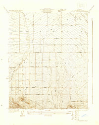
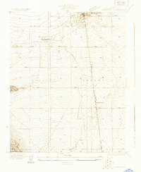
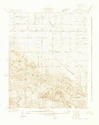
Other maps of this area

1900 · Tujunga
USGS Topo · 1:62,500

1901 · Southern California Sheet No. 1
USGS Topo · 1:250,000

1903 · Rock Creek
USGS Topo · 1:62,500

1904 · Southern California Sheet No. 1
USGS Topo · 1:250,000

1915 · Elizabeth Lake
USGS Topo · 1:125,000

1917 · Elizabeth Lake
USGS Topo · 1:125,000
1930 · Little Rock
USGS Topo · 1:24,000
1930 · Lancaster
USGS Topo · 1:24,000
1930 · Pearland
USGS Topo · 1:24,000
1930 · West Alpine Butte
USGS Topo · 1:24,000