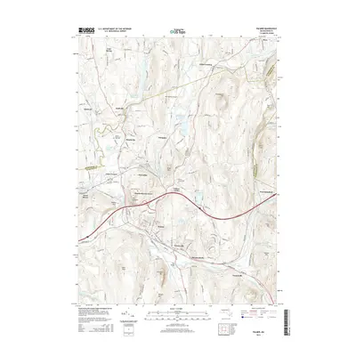
2015 Map of Palmer
USGS Topo · Published 2015About this map
Palmer and its surrounding mill villages sit at a geographical crossroads where the Ware River, Swift River, and Quaboag River converge to form the Chicopee River. This 2015 update shows a landscape shaped by water and industry, from the dense residential clusters of Bondsville, Thorndike, and Three Rivers to the prominent industrial corridors serviced by CSX Transportation. The topography is defined by significant elevations such as Mt Dumplin, Chicopee Mtn, and Pattaquattic Hill, which separate the river valleys from the southern reaches of the Swift River Reservoir. Genealogists will find a wealth of local burial sites including Hillcrest Cem, Saints Peter and Paul Cem, and Palmer Center Cem. The area’s aviation history is represented by the Metropolitan Airport located north of Whipples, while smaller residential developments like Meadowbrook Green and Tenneyville illustrate modern expansion within the traditional village framework.
Find a feature on this map
171 named features on this map. Tap any name to fly to it.
Don’t see what you’re looking for? This feature index may not catch every label — zoom into the map to look around manually.
Map Details
Editions of this 2015 Palmer Map
This is the sole edition of this map. No revisions or reprints were ever made.
Other maps of this area

1887 · Brookfield
USGS Topo · 1:62,500

1887 · Palmer
USGS Topo · 1:62,500

1887 · Belchertown
USGS Topo · 1:62,500

1887 · Barre
USGS Topo · 1:62,500

1889 · Palmer
USGS Topo · 1:62,500

1889 · Barre
USGS Topo · 1:62,500

1890 · Belchertown
USGS Topo · 1:62,500

1890 · Brookfield
USGS Topo · 1:62,500

1893 · Palmer
USGS Topo · 1:62,500

1893 · Belchertown
USGS Topo · 1:62,500