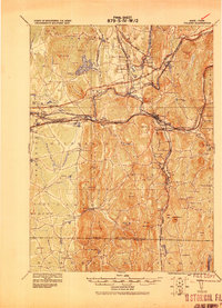
1919 Map of Palmer
USGS Topo · Published 1919About this map
The Chicopee River valley serves as a bustling industrial corridor in this early 20th-century military survey, anchored by the town of Palmer. A complex web of transportation defines the landscape, where the Central Vermont Railroad and the Boston and Maine Railroad intersect at vital transit points like Barretts Junction and Collins Depot. These rails facilitated the movement of goods from local industry, such as the Granite Quarry and Fosketts Mill, while linking established communities like Monson, Wilbraham, and Ludlow.
Find a feature on this map
120 named features on this map. Tap any name to fly to it.
Don’t see what you’re looking for? This feature index may not catch every label — zoom into the map to look around manually.
Map Details
Editions of this 1919 Palmer Map
This is the sole edition of this map. No revisions or reprints were ever made.
Other maps of this area

1885 · Northampton
USGS Topo · 1:62,500

1886 · Springfield
USGS Topo · 1:62,500

1886 · Northampton
USGS Topo · 1:62,500

1887 · Brookfield
USGS Topo · 1:62,500

1887 · Palmer
USGS Topo · 1:62,500

1887 · Belchertown
USGS Topo · 1:62,500

1887 · Barre
USGS Topo · 1:62,500

1889 · Springfield
USGS Topo · 1:62,500

1889 · Palmer
USGS Topo · 1:62,500

1889 · Barre
USGS Topo · 1:62,500