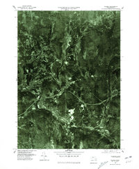
1975 Map of Palmer
USGS Topo · Published 1981About this map
The Quaboag River and Ware River converge at the industrial heart of Three Rivers, forming a complex water system that historically powered the mill towns of this Massachusetts corridor. This 1975 orthophoto quadrangle provides a clear look at the landscape just as the mid-century infrastructure evolved, showing the path of the Massachusetts Turnpike as it cuts across the southern portion of the sheet near Palmer Center. Unlike traditional topographic maps, this aerial imagery captures the dense residential grids and mill structures in Bondsville and Thorndike with photographic precision.
Find a feature on this map
10 named features on this map. Tap any name to fly to it.
Don’t see what you’re looking for? This feature index may not catch every label — zoom into the map to look around manually.
Map Details
Editions of this 1975 Palmer Map
This is the sole edition of this map. No revisions or reprints were ever made.
Other maps of this area

1887 · Brookfield
USGS Topo · 1:62,500

1887 · Palmer
USGS Topo · 1:62,500

1887 · Belchertown
USGS Topo · 1:62,500

1887 · Barre
USGS Topo · 1:62,500

1889 · Palmer
USGS Topo · 1:62,500

1889 · Barre
USGS Topo · 1:62,500

1890 · Belchertown
USGS Topo · 1:62,500

1890 · Brookfield
USGS Topo · 1:62,500

1893 · Palmer
USGS Topo · 1:62,500

1893 · Belchertown
USGS Topo · 1:62,500