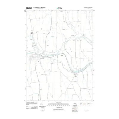
2010 Map of Palmyra
USGS Topo · Published 2010About this map
Hill Cumorah rises south of the village, marking a landscape defined by significant religious and maritime history. This 2010 survey details the modern layout of the corridor where the Erie Canal flows toward a distinctive basin known as The Wide Water near Port Gibson. The mapping reveals a high density of ancestral sites, including the Lemuel Durfee Burying Ground, Swift Burying Ground, and the adjacent Palmyra Village Cemetery and Saint Anne's Catholic Cemetery.
Find a feature on this map
99 named features on this map. Tap any name to fly to it.
Don’t see what you’re looking for? This feature index may not catch every label — zoom into the map to look around manually.
Map Details
Editions of this 2010 Palmyra Map
This is the sole edition of this map. No revisions or reprints were ever made.
Other maps of this area

1899 · Palmyra
USGS Topo · 1:62,500

1900 · Macedon
USGS Topo · 1:62,500

1900 · Canandaigua
USGS Topo · 1:62,500

1902 · Phelps
USGS Topo · 1:62,500

1902 · Palmyra
USGS Topo · 1:62,500

1903 · Canandaigua
USGS Topo · 1:62,500

1942 · Ontario
USGS Topo · 1:31,680

1942 · Canandaigua
USGS Topo · 1:31,680

1943 · Phelps
USGS Topo · 1:31,680

1943 · Williamson
USGS Topo · 1:31,680