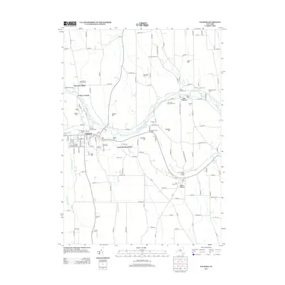
2013 Map of Palmyra
USGS Topo · Published 2013About this map
Palmyra and its surrounding Ontario County landscape are defined by the enduring path of the Erie Canal, which winds through the center of the sheet near Ganargua Cr. This modern survey reveals a dense network of family history and local landmarks, from the Palmyra Union Agricultural Society Fair Grounds on the western edge to the notable expansion of The Wide Waters near Port Gibson. The map serves as a vital resource for genealogists, recording numerous small burial sites such as the Lemuel Durfee Burying Ground, Swift Burying Ground, and the Hopkins Burying Ground. Transportation history is visible in the footprint of the Trolley Bed Road Park and several historic crossings like the Division Street Bridge and Galloway Road Bridge. Smaller settlements like Marquart Village and East Palmyra punctuate a landscape of drumlins and hills, including Bear Hill and Hogback Hill.
Find a feature on this map
133 named features on this map. Tap any name to fly to it.
Don’t see what you’re looking for? This feature index may not catch every label — zoom into the map to look around manually.
Map Details
Editions of this 2013 Palmyra Map
This is the sole edition of this map. No revisions or reprints were ever made.
Other maps of this area

1899 · Palmyra
USGS Topo · 1:62,500

1900 · Macedon
USGS Topo · 1:62,500

1900 · Canandaigua
USGS Topo · 1:62,500

1902 · Phelps
USGS Topo · 1:62,500

1902 · Palmyra
USGS Topo · 1:62,500

1903 · Canandaigua
USGS Topo · 1:62,500

1942 · Ontario
USGS Topo · 1:31,680

1942 · Canandaigua
USGS Topo · 1:31,680

1943 · Phelps
USGS Topo · 1:31,680

1943 · Williamson
USGS Topo · 1:31,680