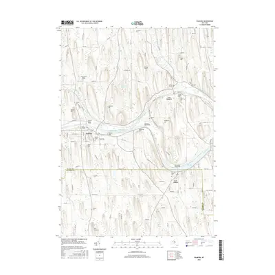
2016 Map of Palmyra
USGS Topo · Published 2016About this map
Palmyra and the surrounding drumlin-rich landscape of Wayne and Ontario counties are defined by the winding course of the Erie Canal. This 2016 survey highlights the significant local history and genealogy found in the region's burial grounds, ranging from the central Palmyra Village Cem and Saint Anne's Catholic Cem to smaller family plots like the Lemuel Durfee Burying Ground and Hopkins Burying Ground. The terrain is famously shaped by glacial activity, featuring prominent elevations such as Hill Cumorah and Hogback Hill. Waterways like Ganargua Creek and Red Creek weave through the township, while specialized features like The Wide Waters and Huckleberry Swamp punctuate the agricultural and wooded areas. The presence of the Oak Ridge Airport and multiple bridge crossings, such as the Galloway Road Bridge, shows the modern infrastructure layered over this 19th-century canal corridor.
Find a feature on this map
109 named features on this map. Tap any name to fly to it.
Don’t see what you’re looking for? This feature index may not catch every label — zoom into the map to look around manually.
Map Details
Editions of this 2016 Palmyra Map
This is the sole edition of this map. No revisions or reprints were ever made.
Other maps of this area

1899 · Palmyra
USGS Topo · 1:62,500

1900 · Macedon
USGS Topo · 1:62,500

1900 · Canandaigua
USGS Topo · 1:62,500

1902 · Phelps
USGS Topo · 1:62,500

1902 · Palmyra
USGS Topo · 1:62,500

1903 · Canandaigua
USGS Topo · 1:62,500

1942 · Ontario
USGS Topo · 1:31,680

1942 · Canandaigua
USGS Topo · 1:31,680

1943 · Phelps
USGS Topo · 1:31,680

1943 · Williamson
USGS Topo · 1:31,680