
2023 Map of Palmyra
USGS Topo · Published 2023About this map
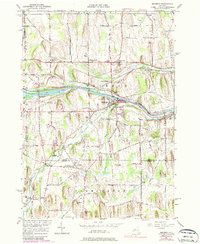
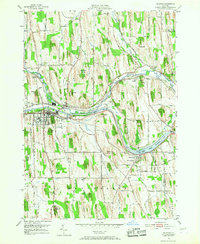
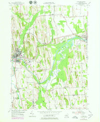
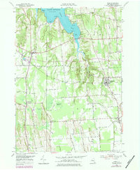
Palmyra stands at a significant intersection of New York transportation history, where the modern path of the Erie Canal cuts through a landscape defined by glacial drumlins and historical settlement. The village is densely detailed, showing the layout of the commercial center along W Main St and E Main St near the Po. To the south, Hill Cumorah rises as a prominent landmark, while the canal widens into the expansive Wide Waters near the Wayne and Ontario county line.
Find a feature on this map
125 named features on this map. Tap any name to fly to it.
Don’t see what you’re looking for? This feature index may not catch every label — zoom into the map to look around manually.
Map Details
Editions of this 2023 Palmyra Map
This is the sole edition of this map. No revisions or reprints were ever made.
Historical Maps of Manchester Through Time
36 maps found
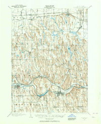
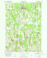
1899 Palmyra
Wayne County, NY
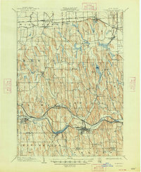
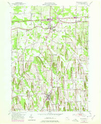
1902 Palmyra
Wayne County, NY
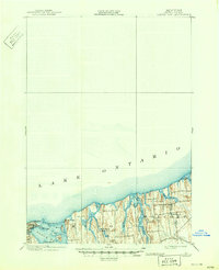
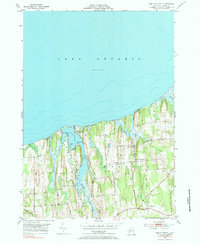
1902 Sodus Bay
Wayne County, NY

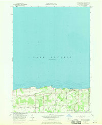
1942 Ontario
Wayne County, NY

1943 Lyons
Wayne County, NY

1943 North Wolcott
Wayne County, NY

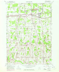
1943 Palmyra
Wayne County, NY

1943 Rose
Wayne County, NY

1943 Savannah
Wayne County, NY

1943 Sodus
Wayne County, NY

1943 Williamson
Wayne County, NY

1943 Wolcott
Wayne County, NY
1951 Macedon
Wayne County, NY
1952 Furnaceville
Wayne County, NY
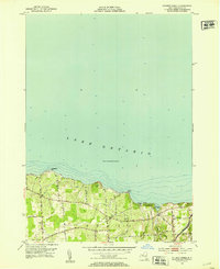
1952 Ontario
Wayne County, NY
1952 Palmyra
Wayne County, NY
1952 Salmon Creek
Wayne County, NY
1952 Sodus
Wayne County, NY
1952 Williamson
Wayne County, NY
1953 Lyons
Wayne County, NY
1953 North Wolcott
Wayne County, NY
1953 Rose
Wayne County, NY
1953 Savannah
Wayne County, NY
1953 Wolcott
Wayne County, NY

2023 Furnaceville
Wayne County, NY

2023 Lyons
Wayne County, NY

2023 Macedon
Wayne County, NY

2023 North Wolcott
Wayne County, NY

2023 Ontario
Wayne County, NY
2023 Palmyra
Wayne County, NY

2023 Rose
Wayne County, NY

2023 Salmon Creek
Wayne County, NY

2023 Savannah
Wayne County, NY

2023 Sodus
Wayne County, NY

2023 Williamson
Wayne County, NY

2023 Wolcott
Wayne County, NY