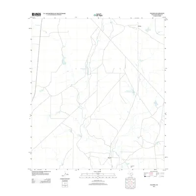
2012 Map of Paloma
USGS Topo · Published 2012About this map
Elm Creek defines the drainage of this South Texas landscape, flowing south through a region marked by extensive ranching infrastructure and localized water management. The settlement of Paloma sits near the creek's lower reach, while the railroad siding at Darling anchors the northern portion of the map. This area is characterized by an intricate network of tanks and man-made reservoirs, which are essential for livestock in the semi-arid brush country.
Find a feature on this map
13 named features on this map. Tap any name to fly to it.
Don’t see what you’re looking for? This feature index may not catch every label — zoom into the map to look around manually.
Map Details
Editions of this 2012 Paloma Map
This is the sole edition of this map. No revisions or reprints were ever made.
Other maps of this area

1896 · Brackett
USGS Topo · 1:125,000

1897 · Brackett
USGS Topo · 1:125,000

1940 · Paloma
USGS Topo · 1:62,500

1940 · Quemado
USGS Topo · 1:62,500

1941 · Tequesquite Creek
USGS Topo · 1:62,500

1944 · Tequesquite Creek
USGS Topo · 1:62,500

1944 · Spofford
USGS Topo · 1:62,500

1958 · Eagle Pass
USGS Topo · 1:250,000

1958 · Del Rio
USGS Topo · 1:250,000

1964 · Del Rio
USGS Topo · 1:250,000