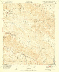
1950 Map of Palomar Observatory
USGS Topo · Published 1950About this map
Palomar Observatory dominates the high elevations of Palomar Mountain in this 1950 survey, showcasing the site of the world-renowned Hale Telescope (200-inch) and its supporting 18-inch counterpart. The rugged topography of the Cleveland National Forest is deeply etched by the West Fork San Luis Rey River and numerous canyons, while the La Jolla Indian Reservation occupies the southwestern terrain. Settlement is sparse, represented by mountain camps like Crestline Camp and the small community of La Jolla Amago. Evidence of local mineral interests appears on the eastern slopes of Aguanga Mountain, where the Ware Mine and the inactive Maple Lode Mine are located. High-altitude meadows such as Mendenhall Valley and Pedley Valley contrast with the steep ridges leading to High Point, where a lookout once surveyed the expansive San Diego County backcountry.
Find a feature on this map
46 named features on this map. Tap any name to fly to it.
Don’t see what you’re looking for? This feature index may not catch every label — zoom into the map to look around manually.
Map Details
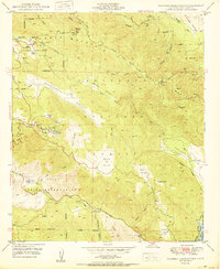
Editions of this 1950 Palomar Observatory Map
2 editions found
Other maps of this area

1903 · Ramona
USGS Topo · 1:125,000

1904 · Southern California Sheet No. 2
USGS Topo · 1:250,000

1939 · Warner Springs
USGS Topo · 1:62,500

1939 · Santa Ysabel
USGS Topo · 1:62,500

1939 · Palomar Mountain
USGS Topo · 1:62,500

1942 · Ramona
USGS Topo · 1:62,500

1943 · Santa Ysabel
USGS Topo · 1:62,500

1943 · Warner Springs
USGS Topo · 1:62,500

1947 · Ramona
USGS Topo · 1:62,500

1947 · Santa Ana
USGS Topo · 1:250,000