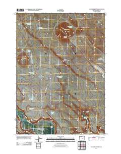
2011 Map of Palomino Buttes
USGS Topo · Published 2011About this map
Silver Creek flows through the southwestern corner of this Harney County landscape, anchoring a terrain defined by high desert basins and volcanic ridges. The map reveals an intricate network of water management essential to the high desert, featuring remote catchments like Snow Storm Reservoir, Fay Canyon Reservoir, and the Palomino Rim Reservoir. Transportation across this expansive territory is marked by historic pathways such as the Cote Grade and Ferry Grade, which navigate the elevation changes between Warm Springs Valley and the Palomino Rim. The nomenclature of the area, including Lone Rabbit Water Hole and Obiaque Water Hole, reflects a history deeply tied to the search for reliable water sources for livestock and travelers in the Oregon interior. Significant landmarks such as Palomino Buttes and Grassy Butte provide vertical orientation across the open range.
Find a feature on this map
26 named features on this map. Tap any name to fly to it.
Don’t see what you’re looking for? This feature index may not catch every label — zoom into the map to look around manually.
Map Details
Editions of this 2011 Palomino Buttes Map
This is the sole edition of this map. No revisions or reprints were ever made.
Other maps of this area

1955 · Burns
USGS Topo · 1:250,000

1958 · Burns
USGS Topo · 1:250,000

1959 · Burns
USGS Topo · 1:250,000

1959 · Dog Mountain
USGS Topo · 1:62,500

1960 · Burns
USGS Topo · 1:62,500

1979 · Moon Reservoir
USGS Topo · 1:24,000

1980 · Iron Mtn. Flat
USGS Topo · 1:24,000

1980 · Stinking Lake
USGS Topo · 1:24,000

1980 · Palomino Buttes
USGS Topo · 1:24,000

1981 · Sage Hen Hill
USGS Topo · 1:24,000