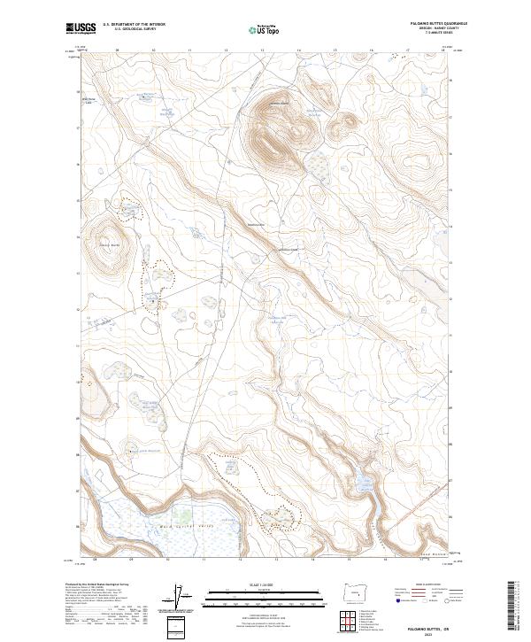
2023 Map of Palomino Buttes
USGS Topo · Published 2023About this map
Warm Springs Valley and the high desert terrain of Harney County are defined here by a network of seasonal water sources and ranching infrastructure. The landscape is dominated by the volcanic forms of Palomino Buttes and the steep Palomino Rim, which is traversed by the Palomino Grade. This 2023 survey records an arid environment where ranching history is evidenced by the numerous reservoirs and water holes necessary for livestock, such as Snow Storm Reservoir, Bunch Grass Reservoir, and the Obiaque Water Hole. To the southwest, Silver Creek flows toward the valley floor, while a series of shallow lakes including Cote Lake and Umbrite Lake collect in the lowlands. The importance of access across this isolated range is marked by named routes like Double O Ranch Rd and the Lost Lake-Stock Trail-RIBS 210786-Trl Chain Lake Rd.
Find a feature on this map
28 named features on this map. Tap any name to fly to it.
Don’t see what you’re looking for? This feature index may not catch every label — zoom into the map to look around manually.
Map Details
Editions of this 2023 Palomino Buttes Map
This is the sole edition of this map. No revisions or reprints were ever made.
Other maps of this area

1955 · Burns
USGS Topo · 1:250,000

1958 · Burns
USGS Topo · 1:250,000

1959 · Burns
USGS Topo · 1:250,000

1959 · Dog Mountain
USGS Topo · 1:62,500

1960 · Burns
USGS Topo · 1:62,500

1979 · Moon Reservoir
USGS Topo · 1:24,000

1980 · Iron Mtn. Flat
USGS Topo · 1:24,000

1980 · Stinking Lake
USGS Topo · 1:24,000

1980 · Palomino Buttes
USGS Topo · 1:24,000

1981 · Sage Hen Hill
USGS Topo · 1:24,000