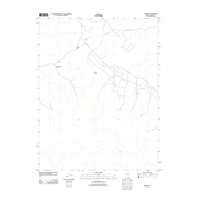
2011 Map of Pamlico
USGS Topo · Published 2011About this map
Pamlico and La Panta sit at the center of this 2011 survey in Nevada's Mineral County, representing the long-standing mineral-rich landscape of the Great Basin. The topography is defined by significant drainage systems and geological features, including the deep cuts of Rhodes Cañon and the aptly named Never Sweat Canyon. These landforms imply a history of prospectors navigating the arid terrain where water sources like Sagundai Spring would have been vital for survival and operations. Modern infrastructure is represented by Powerline Rd and Garfield Flats Rd, which cross the high desert floor near McGill Canyon. The map provides a precise view of the local drainage patterns and terrain relief that have dictated travel and settlement in this corner of Nevada for over a century.
Find a feature on this map
8 named features on this map. Tap any name to fly to it.
Don’t see what you’re looking for? This feature index may not catch every label — zoom into the map to look around manually.
Map Details
Editions of this 2011 Pamlico Map
This is the sole edition of this map. No revisions or reprints were ever made.
Other maps of this area

1909 · Hawthorne
USGS Topo · 1:250,000

1911 · Hawthorne
USGS Topo · 1:250,000

1915 · Hawthorne
USGS Topo · 1:250,000

1948 · Walker Lake
USGS Topo · 1:250,000

1955 · Powell Mtn
USGS Topo · 1:62,500

1955 · Hawthorne
USGS Topo · 1:62,500

1957 · Walker Lake
USGS Topo · 1:250,000

1962 · Walker Lake
USGS Topo · 1:250,000

1964 · Walker Lake
USGS Topo · 1:250,000

1967 · Pamlico
USGS Topo · 1:24,000