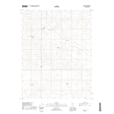
2018 Map of Pamlico
USGS Topo · Published 2018About this map
Pamlico sits within a complex network of desert canyons in the Garfield Hills of Mineral County. This arid landscape is defined by its dramatic elevation changes and named drainages such as Pamlico Canyon, Rhodes Canyon, and McGill Canyon. The settlement pattern here is sparse, centered on these high-altitude features where local history often revolves around the ephemeral water sources and mineral prospects. Isolated water points like Sagundai Spring highlight the critical role of moisture in this environment. The presence of Bromide Canyon and Never Sweat Canyon suggests a history of mining and exploration, as these names often reflect the grueling conditions and geological discoveries of early miners in the Great Basin. Access to this remote terrain is maintained via Garfield Flats Rd and Garfield Rd, which thread through the gaps in the hills.
Find a feature on this map
14 named features on this map. Tap any name to fly to it.
Don’t see what you’re looking for? This feature index may not catch every label — zoom into the map to look around manually.
Map Details
Editions of this 2018 Pamlico Map
This is the sole edition of this map. No revisions or reprints were ever made.
Other maps of this area

1909 · Hawthorne
USGS Topo · 1:250,000

1911 · Hawthorne
USGS Topo · 1:250,000

1915 · Hawthorne
USGS Topo · 1:250,000

1948 · Walker Lake
USGS Topo · 1:250,000

1955 · Powell Mtn
USGS Topo · 1:62,500

1955 · Hawthorne
USGS Topo · 1:62,500

1957 · Walker Lake
USGS Topo · 1:250,000

1962 · Walker Lake
USGS Topo · 1:250,000

1964 · Walker Lake
USGS Topo · 1:250,000

1967 · Pamlico
USGS Topo · 1:24,000