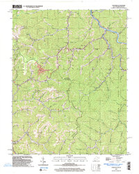
2023 Map of Panther
USGS Topo · Published 2023About this map
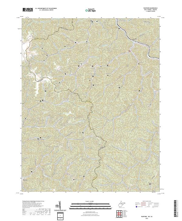
State Line Ridge defines the southern boundary of this territory, where the borders of West Virginia and Virginia meet amidst a dense network of mountain forks and hollows. The settlement of Panther sits at the northern edge along the Tug Fork, serving as a gateway to the extensive Panther State Forest. The map is particularly notable for its high density of family cemeteries, such as Sullivan Cem, Fred Lester Cem, and Robertson Cem, which are scattered along nearly every major drainage including Bull Creek and Panther Creek. These burial sites, alongside isolated landmarks like Sheep Knob and Wildcat Hollow, provide a detailed genealogical record of the families who settled these narrow valleys. The terrain's character is shaped by deep incisions from waterways like Lick Branch and Trap Fork, creating a landscape where roads like Panther Creek Rd must follow the natural contours of the water.
Find a feature on this map
111 named features on this map. Tap any name to fly to it.
Don’t see what you’re looking for? This feature index may not catch every label — zoom into the map to look around manually.
Map Details
Editions of this 2023 Panther Map
This is the sole edition of this map. No revisions or reprints were ever made.
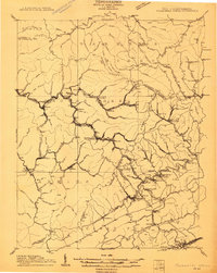
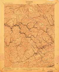
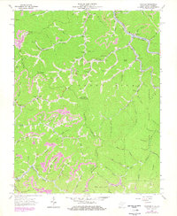
Historical Maps of Panther Through Time
5 maps found