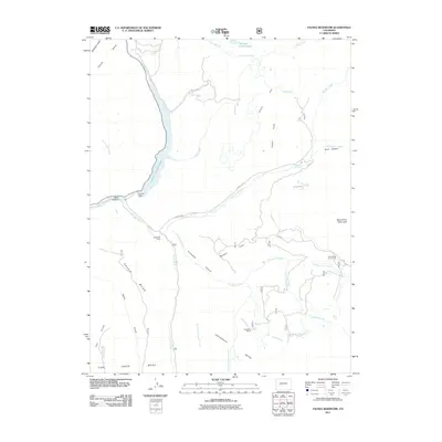
2011 Map of Paonia Reservoir
USGS Topo · Published 2011About this map
Paonia Reservoir and the Paonia Dam dominate this high-altitude landscape where Muddy Creek and Anthracite Creek converge. The topography is defined by massive flat-topped landforms including Raven Mesa, Snowshoe Mesa, and Coal Creek Mesa, which rise above deep incisions like Dark Canyon and Snowshoe Canyon. In this 2011 survey, the area remains a landscape of ranching and remote outposts, evidenced by the presence of Hotchkiss Ranch, Snowshoe Cabin, and Snowshoe Cow Camp. A network of irrigation infrastructure, including the Twin-Forks Ditch, Elkhorn Stump Ditch, and Fillmore Ditch, supports the local geography. Significant natural landmarks such as Marcellina Mountain and Erickson Springs provide further orientation within this complex system of gulches and creeks.
Find a feature on this map
41 named features on this map. Tap any name to fly to it.
Don’t see what you’re looking for? This feature index may not catch every label — zoom into the map to look around manually.
Map Details
Editions of this 2011 Paonia Reservoir Map
This is the sole edition of this map. No revisions or reprints were ever made.
Other maps of this area

1888 · Anthracite
USGS Topo · 1:62,500

1889 · Anthracite
USGS Topo · 1:62,500

1893 · Anthracite
USGS Topo · 1:62,500

1894 · Anthracite
USGS Topo · 1:62,500

1938 · Mt. Gunnison
USGS Topo · 1:48,000

1945 · Mount Gunnison
USGS Topo · 1:62,500

1956 · Montrose
USGS Topo · 1:250,000

1957 · Leadville
USGS Topo · 1:250,000

1959 · Leadville
USGS Topo · 1:250,000

1959 · Montrose
USGS Topo · 1:250,000