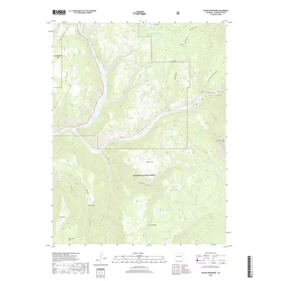
2019 Map of Paonia Reservoir
USGS Topo · Published 2019About this map
Paonia Reservoir dominates the drainage patterns of this high-elevation landscape, where the waters of Muddy Cr and Anthracite Cr converge. Managed as part of the Gunnison National Forest, the terrain is defined by dramatic elevation shifts from the basin floor to the peaks of the Raggeds. A complex network of historic irrigation infrastructure, including the Twin Forks Ditch and Fillmore Ditch, illustrates the engineering required to move water through this vertical geography. High-altitude meadows like Watson Flats and landmarks such as Marcellina Mtn stand alongside specialized routes like the Munsey Ruby Stock Driveway, which points to the long-standing livestock traditions of the region. From the deep recesses of Dark Canyon to the wide expanse of Raven Mesa, this survey documents a wilderness area where natural hydrology and human-made reservoirs intersect.
Find a feature on this map
43 named features on this map. Tap any name to fly to it.
Don’t see what you’re looking for? This feature index may not catch every label — zoom into the map to look around manually.
Map Details
Editions of this 2019 Paonia Reservoir Map
This is the sole edition of this map. No revisions or reprints were ever made.
Other maps of this area

1888 · Anthracite
USGS Topo · 1:62,500

1889 · Anthracite
USGS Topo · 1:62,500

1893 · Anthracite
USGS Topo · 1:62,500

1894 · Anthracite
USGS Topo · 1:62,500

1938 · Mt. Gunnison
USGS Topo · 1:48,000

1945 · Mount Gunnison
USGS Topo · 1:62,500

1956 · Montrose
USGS Topo · 1:250,000

1957 · Leadville
USGS Topo · 1:250,000

1959 · Leadville
USGS Topo · 1:250,000

1959 · Montrose
USGS Topo · 1:250,000