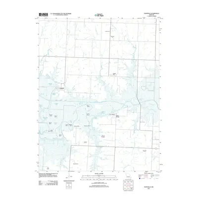
2011 Map of Papinville
USGS Topo · Published 2011About this map
The confluence of the Marais des Cygnes River and the Osage River defines this landscape in Vernon County, where river bends and seasonal sloughs create a complex riparian environment. Local history and genealogy are anchored by several burial grounds, including Maus Cemetery, Flat Rock Cemetery, and the Garrison and Westfall Cemetery. The settlement of Papinville sits near the river's edge, characterized by the winding waterway that features numerous named curves such as Beasley Bend and Schapeler Bend. High ground is found at Hammer Hill and Blue Mound, providing relief from the wetlands and ponds like Carrico Lake and Fix Pond. The presence of the Bates County Ditch indicates the extensive drainage efforts required to manage this river-bottom territory, while small communities like Prairie City and Indian Springs mark the established crossroads of the early 21st century.
Find a feature on this map
45 named features on this map. Tap any name to fly to it.
Don’t see what you’re looking for? This feature index may not catch every label — zoom into the map to look around manually.
Map Details
Editions of this 2011 Papinville Map
This is the sole edition of this map. No revisions or reprints were ever made.
Other maps of this area

1886 · Nevada
USGS Topo · 1:125,000

1887 · Butler
USGS Topo · 1:125,000

1894 · Butler
USGS Topo · 1:125,000

1894 · Nevada
USGS Topo · 1:125,000

1934 · Papinsville
USGS Topo · 1:24,000

1934 · Rockville
USGS Topo · 1:24,000

1936 · Rich Hill
USGS Topo · 1:24,000

1938 · Horton
USGS Topo · 1:24,000

1939 · Horton
USGS Topo · 1:24,000

1939 · Eldorado Springs North
USGS Topo · 1:24,000