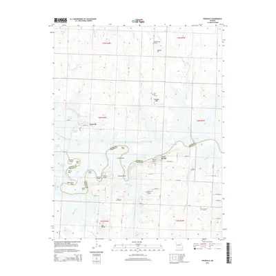
2014 Map of Papinville
USGS Topo · Published 2014About this map
The Marais des Cygnes River meanders across the border of Bates and Vernon Counties, defining the landscape of the Papinville area. This terrain is characterized by complex river bends such as Mosley Bend and Schapeler Bend, alongside engineering efforts like the Bates County Drainage Ditch. The settlement at Prairie City and the scattered rural landmarks of Indian Springs highlight the agricultural and residential patterns of the early 21st century.
Find a feature on this map
63 named features on this map. Tap any name to fly to it.
Don’t see what you’re looking for? This feature index may not catch every label — zoom into the map to look around manually.
Map Details
Editions of this 2014 Papinville Map
This is the sole edition of this map. No revisions or reprints were ever made.
Other maps of this area

1886 · Nevada
USGS Topo · 1:125,000

1887 · Butler
USGS Topo · 1:125,000

1894 · Butler
USGS Topo · 1:125,000

1894 · Nevada
USGS Topo · 1:125,000

1934 · Papinsville
USGS Topo · 1:24,000

1934 · Rockville
USGS Topo · 1:24,000

1936 · Rich Hill
USGS Topo · 1:24,000

1938 · Horton
USGS Topo · 1:24,000

1939 · Horton
USGS Topo · 1:24,000

1939 · Eldorado Springs North
USGS Topo · 1:24,000