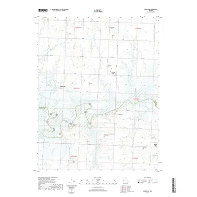
2017 Map of Papinville
USGS Topo · Published 2017About this map
The Marais des Cygnes River carves a winding path across this portion of the Missouri landscape, defining the border between Bates and Vernon Counties. This 2017 edition illustrates a region shaped by complex hydrology, where the river's loops create named features like Mosley Bend, Camm Bend, and Apple Garth Bend. The legacy of 19th-century settlement is preserved through numerous small burial grounds, including the Flat Rock Cem and Garrison and Westfall Cem.
Find a feature on this map
75 named features on this map. Tap any name to fly to it.
Don’t see what you’re looking for? This feature index may not catch every label — zoom into the map to look around manually.
Map Details
Editions of this 2017 Papinville Map
This is the sole edition of this map. No revisions or reprints were ever made.
Other maps of this area

1886 · Nevada
USGS Topo · 1:125,000

1887 · Butler
USGS Topo · 1:125,000

1894 · Butler
USGS Topo · 1:125,000

1894 · Nevada
USGS Topo · 1:125,000

1934 · Papinsville
USGS Topo · 1:24,000

1934 · Rockville
USGS Topo · 1:24,000

1936 · Rich Hill
USGS Topo · 1:24,000

1938 · Horton
USGS Topo · 1:24,000

1939 · Horton
USGS Topo · 1:24,000

1939 · Eldorado Springs North
USGS Topo · 1:24,000