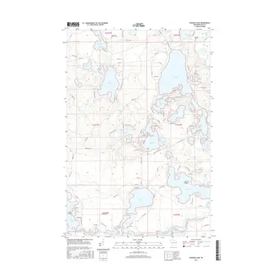
2015 Map of Papoose Lake
USGS Topo · Published 2015About this map
The Manitowish River and South Presque Isle River define this corner of Vilas County, where a dense network of glacial lakes dominates the landscape. Settled pockets are evidenced by the Winchester Memorial Cem and Presque Isle Cem, serving as anchors for local genealogy. Large water bodies like Van Vliet Lake and Papoose Lake are connected by minor drainages such as Papoose Cr, illustrating a complex hydrologic system that has long drawn seasonal residents and outdoorsmen. A variety of named islands, including Fox Island and Keith Island in Big Lake, suggest a shoreline shaped by centuries of natural erosion and rising water levels. The road network, including Co Hwy K and numerous timber-access routes like Logging Rd, reflects the area's dual history of industrial forestry and recreational development.
Find a feature on this map
112 named features on this map. Tap any name to fly to it.
Don’t see what you’re looking for? This feature index may not catch every label — zoom into the map to look around manually.
Map Details
Editions of this 2015 Papoose Lake Map
This is the sole edition of this map. No revisions or reprints were ever made.
Other maps of this area

1939 · Trout Lake
USGS Topo · 1:48,000

1939 · Winchester
USGS Topo · 1:48,000

1946 · Winchester
USGS Topo · 1:48,000

1946 · Trout Lake
USGS Topo · 1:48,000

1949 · Trout Lake
USGS Topo · 1:48,000

1955 · Marenisco
USGS Topo · 1:62,500

1955 · Boulder Junction
USGS Topo · 1:62,500

1955 · Winchester
USGS Topo · 1:62,500

1955 · Wakefield
USGS Topo · 1:62,500

1958 · Iron River
USGS Topo · 1:250,000