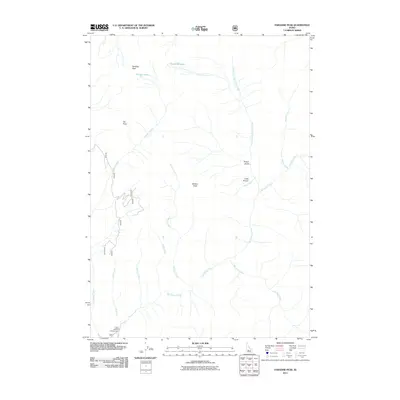
2011 Map of Paradise Peak
USGS Topo · Published 2011About this map
Paradise Peak and Skillern Peak anchor this high-altitude landscape in the Sawtooth National Forest, where numerous drainages converge to feed the central waters of Big Smoky Creek. The topography is defined by steep ridges and glacial features, including Paradise Lake and the Snowslide Lakes. Human presence is concentrated at the Canyon Campground in the southwestern corner, serving as a base for exploring the network of creeks and gulches. The drainage pattern is complex, with North Fork Big Smoky Creek and Skillern Creek carving deep paths through the terrain. Other named landmarks like Elk Point and Pinyon Gulch provide specific points of reference for navigating this backcountry area, while Little Pinyon marks the headwaters of several minor tributaries.
Find a feature on this map
19 named features on this map. Tap any name to fly to it.
Don’t see what you’re looking for? This feature index may not catch every label — zoom into the map to look around manually.
Map Details
Editions of this 2011 Paradise Peak Map
This is the sole edition of this map. No revisions or reprints were ever made.
Other maps of this area

1900 · Sawtooth
USGS Topo · 1:125,000

1955 · Hailey
USGS Topo · 1:250,000

1959 · Hailey
USGS Topo · 1:250,000

1962 · Hailey
USGS Topo · 1:250,000

1964 · Frenchman Creek
USGS Topo · 1:24,000

1964 · Marshall Peak
USGS Topo · 1:24,000

1970 · Sydney Butte
USGS Topo · 1:24,000

1970 · Paradise Peak
USGS Topo · 1:24,000
1970 · Newman Peak
USGS Topo · 1:24,000

1970 · Dollarhide Mtn
USGS Topo · 1:24,000