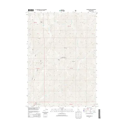
2013 Map of Paradise Peak
USGS Topo · Published 2013About this map
Skillern Hot Springs sits along the banks of Big Smoky Cr within this high-elevation portion of the Sawtooth National Forest. This 2013 survey highlights the complex drainage systems that define this part of Camas County, where Snowslide Cr and Skillern Cr flow from peaks like Paradise Peak and Skillern Peak. The presence of Canyon Campground at the confluence of Canyon Cr and Big Smoky Creek suggests the area's continued importance for recreation and backcountry access via Forest Service road 085. The terrain is characterized by steep elevation changes, moving from the creek bottoms up to high landmarks such as Elk Point and through deep incisions like Pinyon Gulch. The map also preserves the Public Land Survey System grid, including various land parcels such as PB 40 and PB 45.
Find a feature on this map
34 named features on this map. Tap any name to fly to it.
Don’t see what you’re looking for? This feature index may not catch every label — zoom into the map to look around manually.
Map Details
Editions of this 2013 Paradise Peak Map
This is the sole edition of this map. No revisions or reprints were ever made.
Other maps of this area

1900 · Sawtooth
USGS Topo · 1:125,000

1955 · Hailey
USGS Topo · 1:250,000

1959 · Hailey
USGS Topo · 1:250,000

1962 · Hailey
USGS Topo · 1:250,000

1964 · Frenchman Creek
USGS Topo · 1:24,000

1964 · Marshall Peak
USGS Topo · 1:24,000

1970 · Sydney Butte
USGS Topo · 1:24,000

1970 · Paradise Peak
USGS Topo · 1:24,000
1970 · Newman Peak
USGS Topo · 1:24,000

1970 · Dollarhide Mtn
USGS Topo · 1:24,000