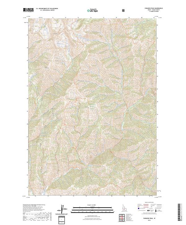
2023 Map of Paradise Peak
USGS Topo · Published 2023About this map
Skillern Hot Springs sits along the southern reaches of this terrain, marking a distinct geothermal point within the Sawtooth National Forest. The landscape is dominated by the Smoky Mountains, where high elevations like Paradise Peak and Skillern Peak overlook a complex network of alpine waters. High-altitude basins cradle Snowslide Lakes and Paradise Lake, feeding the many creeks that carve through the gulches. A network of backcountry routes, including the Skillern Creek Trl and Paradise Creek Trl, trace the steep topography between Elk Point and the drainages of Big Smoky Creek. This map details a high-elevation wilderness where early forest service management and recreational trails define the human presence among the ridges and thermal springs.
Find a feature on this map
43 named features on this map. Tap any name to fly to it.
Don’t see what you’re looking for? This feature index may not catch every label — zoom into the map to look around manually.
Map Details
Editions of this 2023 Paradise Peak Map
This is the sole edition of this map. No revisions or reprints were ever made.
Other maps of this area

1900 · Sawtooth
USGS Topo · 1:125,000

1955 · Hailey
USGS Topo · 1:250,000

1959 · Hailey
USGS Topo · 1:250,000

1962 · Hailey
USGS Topo · 1:250,000

1964 · Frenchman Creek
USGS Topo · 1:24,000

1964 · Marshall Peak
USGS Topo · 1:24,000

1970 · Sydney Butte
USGS Topo · 1:24,000

1970 · Paradise Peak
USGS Topo · 1:24,000
1970 · Newman Peak
USGS Topo · 1:24,000

1970 · Dollarhide Mtn
USGS Topo · 1:24,000